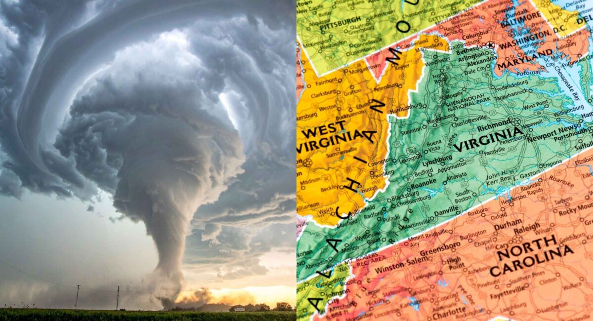
A dangerous Tornado Warning and severe weather outbreak is unfolding across parts of Virginia, Maryland, and the wider Mid-Atlantic on Monday, March 16, 2026. Meteorologists warn that a rare Level 4 “Moderate Risk” of severe storms stretches from the Carolinas to Maryland, meaning conditions are favorable for damaging winds, large hail, and potentially strong tornadoes, especially late afternoon through evening.
In practical terms, that means cities such as Washington, D.C., Baltimore, Richmond, and Raleigh may face rapidly developing storms capable of producing rotating supercells and long-track tornadoes as a powerful storm system moves along the East Coast.
Why the Tornado Warning Risk Is Unusually High Today
Meteorologists rarely issue a Level 4 out of 5 moderate risk in the Mid-Atlantic. In fact, these forecasts only occur a handful of times each decade.
The reason: a nearly perfect combination of atmospheric ingredients.
1. Powerful Jet Stream Winds
A strong dip in the jet stream is pushing intense upper-level winds across the eastern United States. This creates wind shear, which helps thunderstorms rotate and form tornadoes.
2. Warm Moist Air From the South
Moist air surging north from the Gulf and Atlantic provides the fuel thunderstorms need to intensify quickly.
3. A Fast-Moving Cold Front
A powerful cold front sweeping east acts like a trigger, igniting storms along a long squall line stretching hundreds of miles.
Meteorologists warn that this combination could produce supercells ahead of the main storm line, which are the storms most likely to generate tornadoes.
Areas Under Tornado Watch and Severe Storm Threat
The highest risk corridor stretches along the I-95 corridor, one of the most densely populated regions in the United States.
Highest Risk Locations
- Central and eastern Virginia
- Central Maryland
- Washington, D.C. metro area
- Richmond, Virginia
- Baltimore, Maryland
- Raleigh, North Carolina
Forecasters also warn that southern Pennsylvania, North Carolina, and parts of South Carolina may see severe storms capable of producing tornadoes.
When the Storms Will Hit
Timing is critical with this event.
Meteorologists say the most dangerous period will likely occur between late afternoon and evening, which unfortunately coincides with school dismissals and rush-hour traffic across major cities.
Expected Timeline
Morning:
Scattered rain showers and initial thunderstorms begin developing.
Afternoon:
Storms intensify as the atmosphere destabilizes.
Late Afternoon to Evening:
Peak severe weather window — strongest tornado potential.
Late Night:
Storms move offshore into the Atlantic.
Damaging Winds and Hail May Be the Biggest Threat
While tornadoes receive the most attention, forecasters emphasize that destructive straight-line winds could cause the most widespread damage.
Some storm models suggest gusts approaching hurricane strength, capable of:
- Downing trees and power lines
- Damaging roofs and buildings
- Causing widespread power outages
Large hail is also possible in stronger storms.
Across the eastern United States, severe storms have already been producing wind gusts up to 74 mph and widespread disruptions, including flight cancellations and power outages in multiple states.
Why This Storm System Is So Powerful
This severe weather outbreak is part of a massive multi-hazard storm system affecting much of North America.
Meteorologists have described it as a “triple-threat megastorm,” producing snow in the Midwest, severe storms in the South, and tornado risks in the Mid-Atlantic.
Nearly 200 million people across the United States are affected by some form of extreme weather from this system.
That scale makes it one of the most significant weather events of early 2026.
Tornado Watch vs Tornado Warning: What Residents Need to Know
Understanding the difference could save lives.
Tornado Watch
A watch means conditions are favorable for tornado formation. Residents should stay alert and monitor weather updates.
Tornado Warning
A warning means a tornado has been spotted or detected on radar and immediate shelter is required.
Warnings are typically issued minutes before the storm hits, so quick action is essential.
How to Stay Safe During a Tornado Warning
If a Tornado Warning is issued in your area, follow these safety steps immediately:
Step 1: Go to the lowest level of your building.
A basement is safest.
Step 2: Move to an interior room.
Bathrooms, closets, or hallways away from windows work best.
Step 3: Protect your head and neck.
Use helmets, pillows, or heavy blankets.
Step 4: Avoid vehicles and mobile homes.
These offer little protection from tornado winds.
Step 5: Monitor official alerts.
Weather radios, emergency apps, and local news updates are critical.
Impact on Travel and Daily Life
Because the storms coincide with peak commuting hours, transportation disruptions are likely.
Possible impacts include:
- Delayed flights at major East Coast airports
- Highway closures from fallen trees
- School dismissals or closures
- Power outages affecting thousands of homes
Emergency officials across several states have urged residents to prepare emergency kits and review shelter plans before storms arrive.
What Happens After the Storm
Once the cold front moves offshore overnight, temperatures are expected to drop sharply across the East Coast, bringing calmer but colder weather by Tuesday.
However, damage assessments and power restoration could take days depending on the severity of storms.
Final Analysis
From a meteorological standpoint, this event is significant.
Moderate-risk forecasts in the Mid-Atlantic are rare—and when they occur, they demand attention. With strong atmospheric dynamics, dense urban populations in the risk zone, and storms expected during peak activity hours, Monday’s outbreak has the potential to become one of the most impactful severe weather days of 2026 in the eastern United States.
The message from forecasters is simple: stay alert, monitor warnings, and be ready to take shelter quickly.
Because when tornado warnings are issued, every minute matters.