A Weather Radar Update for Dallas and North Texas shows a volatile storm pattern unfolding across the region, with the National Weather Service (NWS) issuing a tornado watch and severe thunderstorm alerts as powerful storms move through the Dallas–Fort Worth metroplex. Radar data from regional stations including WFAA indicates conditions favorable for large hail, damaging winds up to 70 mph, and isolated tornadoes, especially during evening and overnight storm activity. Residents across several counties in North and Central Texas are being urged to closely monitor weather alerts and be prepared to take shelter if warnings are issued.
Why North Texas Is Under a Tornado Watch Right Now
Meteorologists tracking the current storm system say the atmosphere over North Texas has become highly unstable, with warm, moisture-rich air from the Gulf of Mexico colliding with a powerful cold front pushing east across the state.
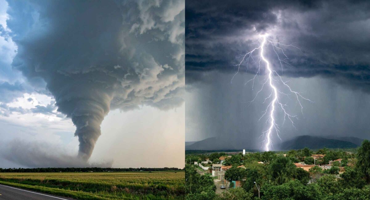
This clash of air masses is a classic early‑spring setup for severe weather across the region commonly known as Tornado Alley. According to forecasts tied to the NWS Fort Worth office, this environment can quickly produce supercell thunderstorms capable of rotating and generating tornadoes.
The tornado watch issued on March 10, 2026, remains active through late evening for multiple counties in North and Central Texas, including areas around Denton, Cooke, Parker, Wise, and Grayson counties.
Under a tornado watch, conditions are favorable for tornado formation, though tornadoes are not yet confirmed. A tornado warning, by contrast, means a tornado has been spotted or detected on radar.
What Dallas Weather Radar Shows Right Now
Weather radar imagery from Dallas‑Fort Worth stations indicates clusters of severe thunderstorms forming west and northwest of the metro area, gradually tracking eastward.
Key radar observations include:
- Strong storm cells producing heavy rainfall
- Hail cores capable of producing 1–2 inch hailstones
- Wind gusts approaching 70 mph
- Rotation signatures in isolated storm cells
Storm tracking services and weather spotters warn that supercells embedded in these clusters could briefly intensify, producing short‑lived tornadoes before weakening.
Some meteorologists monitoring the radar say the highest risk zone currently lies north of Interstate 20, including the Dallas suburbs and parts of the Texoma region.
Counties and Cities Potentially Affected
The current severe weather alerts include multiple counties across North Texas. Communities within the watch area include:
- Denton
- Flower Mound
- Sherman
- Gainesville
- Carrollton
- Decatur
- Weatherford
- Bridgeport
- Graham
These areas fall within the storm corridor expected to experience the strongest thunderstorm activity during this weather event.
Residents in the Dallas–Fort Worth metroplex, one of the largest urban areas in Tornado Alley, frequently experience severe thunderstorms in early spring when atmospheric instability peaks.
Storm Threat Timeline: When Severe Weather Could Peak
Based on the latest forecasts and radar trends, the severe weather window across North Texas generally follows this timeline:
Afternoon:
Initial thunderstorms begin forming west of the metroplex as atmospheric instability builds.
Evening:
Storm clusters strengthen, increasing the risk of hail, damaging winds, and isolated tornadoes.
Overnight:
Storms may move eastward through the region, potentially bringing heavy rain and flash flooding risks in some areas.
Meteorologists stress that storm intensity can fluctuate rapidly. A cell that appears weak on radar can strengthen dramatically within minutes.
Large Hail and Damaging Winds: The Biggest Immediate Risks
While tornadoes often dominate headlines, hail and wind damage typically cause the majority of storm-related losses in North Texas.
Current forecasts warn of hail potentially reaching up to two inches in diameter, large enough to damage vehicles, rooftops, and windows.
Additionally, severe thunderstorms may produce:
- Straight‑line winds exceeding 70 mph
- Frequent lightning strikes
- Localized flash flooding due to heavy rainfall
Weather experts emphasize that straight-line winds can cause damage similar to weaker tornadoes, including downed trees and power outages.
What Residents Should Do During a Tornado Watch
From years of covering severe weather events across Texas, one reality stands out: preparedness matters more than prediction. Storm forecasts narrow the risk area—but once storms begin rotating, events move fast.
Here are the most important safety steps:
1. Monitor Live Weather Radar
Use trusted radar sources like local TV stations or official weather apps to track storm movement.
2. Enable Emergency Alerts
Make sure Wireless Emergency Alerts (WEA) and weather notifications are turned on.
3. Identify a Safe Shelter
The safest place during a tornado warning is:
- A basement, if available
- An interior room on the lowest floor
- Away from windows and exterior walls
4. Keep Emergency Supplies Ready
Prepare a quick-access kit including:
- Flashlights
- Portable phone chargers
- Water
- A battery-powered weather radio
Why Spring Storm Season Is Starting Early in 2026
Meteorologists say the 2026 severe weather season has ramped up earlier than usual, with multiple storm systems already impacting the central United States.
Large-scale atmospheric patterns—particularly the interaction between warm Gulf moisture and colder northern air masses—are driving repeated storm outbreaks from Texas to the Midwest.
Historically, tornado activity increases sharply from March through May, making this period the most dangerous time for severe storms across Tornado Alley.
Final Outlook: More Storms Possible Across North Texas
The latest Weather Radar Update suggests that North Texas may see multiple rounds of storms over the coming days, depending on how the cold front and upper-level disturbance evolve.
While not every storm will produce severe weather, the atmospheric ingredients remain in place for large hail, damaging winds, and isolated tornadoes across the Dallas–Fort Worth region.
From an editorial perspective after years of watching Texas weather patterns: the key takeaway is simple. Radar trends matter more than forecasts once storms begin. Stay alert, watch official updates, and be ready to act quickly if warnings are issued.
Because in North Texas, severe weather doesn’t usually give much notice before it arrives.